

Thanks to a kind and generous donation of time and effort from Edward J. OBrien, Richard C. Morrissey, and the Friends of the Monastery Trails, we have a series of maps of the monastery grounds that show how they looked when the Trappist monks resided here, how the grounds look today, and hiking trail guides so you can go walking on the grounds with ease.
|
Check out the various maps that were created below: |
||
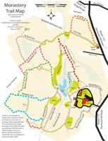
| Marked Monastery Trail Map: During Spring 2016, the various trails were marked with symbols of different shapes and colors by Town employees. This map wsa made so folks could plan their hikes along certain marked paths. |
 |
|
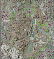 |
Cumberland Monastery Trails: This two-sided map would be a great choice to print and bring with you as you go exploring the various trails here on the monastery grounds. The image was taken based on information collected on June 24, 2012 | |
| Our Lady of the Valley: This simple line map provides a look at how the various buildings on the monastery grounds were used while the Trappist monks resided here. | 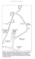 |
|
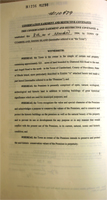 |
Town Ordinance: This is the town ordinance, entitled "Conservation Easement and Restricted Covenants," that was approved on November 8, 2004, to protect the monastary grounds in perpetuity. | |
| Monastery Trails - A Historical Look: This map provides a look at the trails as they looked in 1939. | 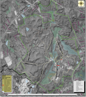 |
|
|
NOTE: All of the maps are in PDF format. If you would like to access the files, you will need to have Adobe Reader installed on your computer. To a download a free version of Adobe Read, click:
 |
||